According to the National Weather Service, meteorologists are forecasting a steady warming trend as a high-pressure ridge builds over the central United States.
Daytime highs are expected to reach the middle and upper 80s by midweek, running more than 10 degrees above normal for early October. Forecasters say confidence is high that the dry pattern will persist through next weekend.
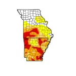
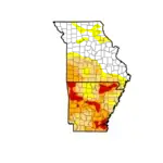
The extended stretch without rainfall is raising concerns about increasingly dry conditions. The National Weather Service is monitoring the potential for elevated fire danger later this week, particularly in areas east of Highway 65 where humidity levels may fall significantly. Light winds should help limit widespread fire-weather concerns for now.