Randy Luna of Stormdar, during an appearance Tuesday on “Ozarks Now”, said the data he has seen from the National Weather Service indicates that the Lakes Region is a dividing line between the area of storm impacts.
Luna says the elements of the remnants of Hurricane Polo along with another frontal system coming together will bring the heaviest chance of rain to the west of Arkansas and Missouri. Luna says while the timing could change, he expects rain to arrive Thursday and produce an inch or two of rain at most.
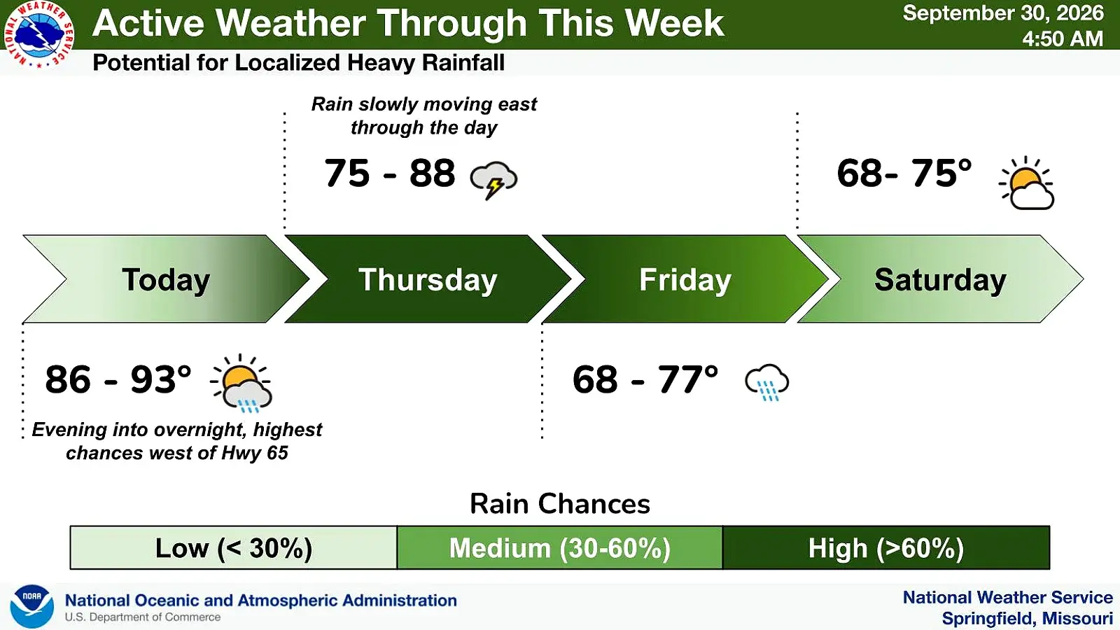
The latest National Weather Service forecast indicates today to be rain free with temperatures into the low 90s across the region.
Rain will start to overspread the area Thursday with rain chances building to between 60 and 80% by the end of the day.
Rain is expected to end by Saturday bringing in cooler air, with highs in the upper 70s by next week.