Today is the last day of summer-like heat prior to a front making its way through the Ozarks on Wednesday.
90-degree highs are forecast for most of the region which could set several temperature records.
Rain moves in early Wednesday morning and will remain in the Lakes Region forecast through early Friday.
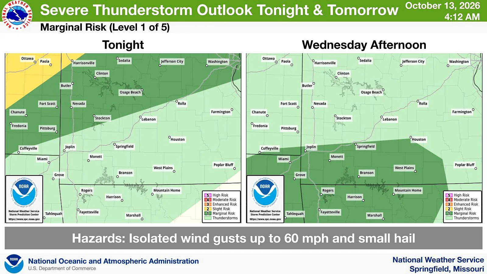
National Weather Service Forecasters predict the heaviest rain will move through the area on Wednesday with a Marginal Risk of Severe Thunderstorms.
Temperatures will go from above to below normal as the weekend approaches with highs Friday only in the 60s and lows in the 40s.